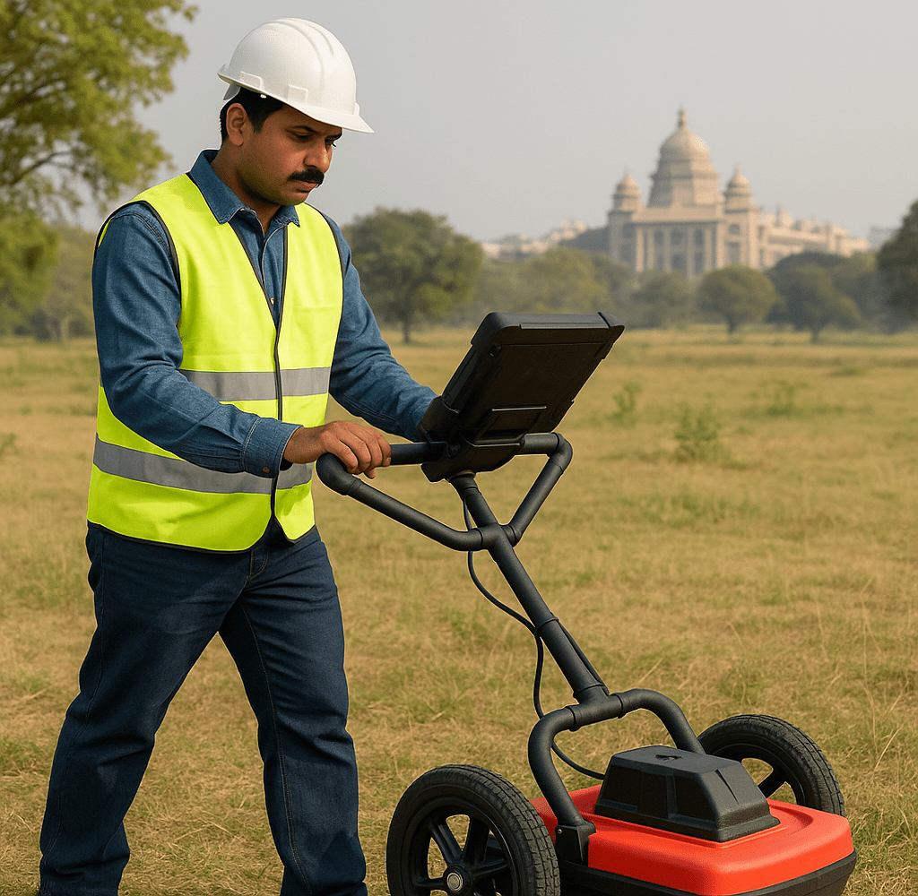
Advanced Ground Penetrating Radar (GPR) Solutions for Civil Structures
Non-invasive structural sensing and subsurface imaging technologies designed to improve safety, accuracy, and decision-making in civil infrastructure.
Ground Penetrating Radar (GPR) for Subsurface Diagnostics
Ground Penetrating Radar (GPR) is a non-destructive evaluation (NDE) technique used to inspect, image, and analyze subsurface conditions in concrete and other civil materials. This electromagnetic sensing technology generates high-frequency radio waves to detect embedded objects, voids, moisture, and structural inconsistencies. Whether inspecting bridge decks, locating rebar in concrete slabs, or analyzing utility pathways, GPR provides invaluable data without disturbing the structure. It supports precise diagnostics and long-term planning in both pre-construction assessments and maintenance operations.
Civil Structure Test Tech, headquartered in Vancouver, BC, is proud to provide cutting-edge GPR systems that align with the high-performance demands of the civil infrastructure industry.
With a robust B2B footprint across North America, we deliver advanced sensing tools, integration-ready solutions, and full-service support for diverse applications in construction, transportation, and public works.

Core Components of Ground Penetrating Radar (GPR) Systems
In addition to offering products and systems developed by our team and trusted partners for Ground Penetrating Radar (GPR), we are proud to carry top-tier technologies from Global Advanced Operations Tek Inc. (GAO Tek Inc.) and Global Advanced Operations RFID Inc. (GAO RFID Inc.). These reliable, high-quality products and systems enhance our ability to deliver comprehensive technologies, integrations, and services you can trust. Where relevant, we have provided direct links to select products and systems from GAO Tek Inc. and GAO RFID Inc.
Hardware Components
- GPR Antennas (500 MHz to 2.6 GHz)
Motion & Position Sensors enhance detection accuracy in subsurface scanning for insured infrastructure evaluation.
- Control Units
GPS IoT Trackers/Devices provide precise location tagging of GPR data for use in insurance claim documentation and asset mapping.
- Data Acquisition Carts or Mounts
Zigbee End Devices enable wireless communication in mobile scanning setups for real-time risk data collection.
- Data Storage Devices
On Premise Edge solutions support local, secure processing and archiving of high-volume scan data for compliance in insurance audits.
Software Solutions
- Signal Processing Software: Advanced signal interpretation for layer separation, object recognition, and noise reduction.
- Visualization Tools: 2D/3D imaging to model subsurface features in real-time or post-scan analysis.
- Report Generators: Automated tools to generate PDF or CAD-compatible reports for compliance and documentation.
Cloud Services
- Cloud Backup and Sharing: Store and access scan data securely via remote servers.
- Collaboration Tools: Enable multi-user access and cross-team coordination on infrastructure evaluations.
- API Access: For integrating GPR data with BIM systems, GIS platforms, or digital twins.
Why Choose Us?
Precision Systems for Structural Performance Evaluation
Key Features
Real-time 2D/3D subsurface imaging with adjustable frequency and depth for multiple material types.
Non-invasive, safe evaluations with AI-assisted target recognition for rebar, voids, and cables.
GPS-enabled positioning with automated documentation for precise mapping and traceability.
Integrations
Third-Party Data Export Support
Export scan results in standard file types (CSV, LAS, DXF) for use in CAD/GIS platforms.
Integration with Digital Twin Systems
Feed real-time or historical data into digital replicas of infrastructure for predictive analysis.
Compatibility
Compatible with Total Stations, GPS, and BIM Platforms GPR tools can sync with geospatial instruments for spatial accuracy in large-scale projects.
Benefits
Clear visibility of hidden subsurface conditions reduces construction risks and delays.
Real-time, high-resolution insights speed up decision-making and reporting.
Scalable, standards-compliant solutions backed by expert training and North American support.
Applications
Bridge deck and concrete inspection for voids, corrosion, and embedment depth.
Utility locating and mapping of underground pipes, conduits, and cables.
Pavement, tunnel, and airport runway assessment for structural layers and anomalies.
Industries
Civil engineering, construction, and transportation infrastructure.
Utilities, public works, environmental, and geotechnical engineering.
Airports, transit systems, government, and defense projects.
Relevant U.S. & Canadian Standards
ASTM D6432
ASTM D4748
ASTM D6087
AASHTO R37
CSA S413
Case Studies
United States – Highway Bridge Rebar Mapping (California DOT)
California’s Department of Transportation deployed GPR across a series of highway bridges to assess rebar corrosion and spacing without disrupting traffic. The data guided proactive rehabilitation, saving millions in emergency repair costs.
United States – Airport Runway Moisture Intrusion Study (Chicago O’Hare)
A GPR system was used to detect subsurface water ingress and pavement layer separation under key runway sections. The resulting analysis enabled optimized resurfacing plans, reducing downtime by 40%.
Canada – Toronto Transit Expansion Project
In Toronto, GPR technology helped the city locate legacy utility lines and underground obstructions before launching a light rail extension. This reduced project delays and ensured safety near historic districts.
For more information, tailored recommendations, or to request a quote on our Ground Penetrating Radar (GPR) systems
Please visit our Contact Us page. Our team at Civil Structure Test Tech is ready to assist with technical support, consultation, or integration planning across your projects in North America. Let us help you build smarter, safer, and with greater confidence.
